
Current despatch is 3 to 5 days.Please contact us if you require faster delivery. Dismiss
Skip to contentWexford sits on Ireland’s sunny south-east coast, where Wexford Harbour opens towards the Irish Sea and the coastline stretches from Hook Head and Bannow Bay to Rosslare Harbour and Carnsore Point. This chart captures the character of the Wexford coast, with its broad sandy bays, tidal waters, harbour approaches and rugged headlands.
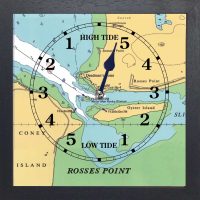
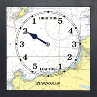
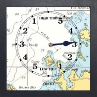
The Wexford tide clock brings this coastal setting into the home, combining the local marine chart with a practical tide display. It is a thoughtful gift for anyone connected with Wexford Harbour, Rosslare, Kilmore Quay, Hook Peninsula or the surrounding coastline, whether they enjoy sailing, fishing, kayaking, beach walks or simply watching the tide change.
A tide clock is a device that tells you if the tide is high or low, and how much time is left before it changes. It works by synchronising with the lunar cycle, which influences the tides. The tide clock has a single hand that rotates once every 12 hours and 25 minutes, which is the average time between two high tides or two low tides. The dial of the tide clock is divided into sections that indicate the state of the tide: high, low, rising, or falling. By looking at the position of the hand, you can tell what the tide is doing and how long it will take to change.
A tide clock can help you plan your activities around Wexford by letting you know when the water is high enough or low enough for your preferred activity. For example, if you want to swim, you might want to avoid low tide, when the water is shallow and cold, and more sandbanks and rocks are exposed. If you want to fish, you might want to avoid high tide, when the water is deep and fast, and the fish are more dispersed. Going sailing, paddleboarding, or kayaking? You might want to choose a time when the tide is rising or falling, which often creates more favourable conditions for these sports. If you want to walk along the shore, you might want to choose a time when the tide is low, which reveals more of the beach, harbour edge and coastal wildlife around Wexford Harbour and the surrounding bays.
A marine chart is a map of the sea and shoreline that shows water depths, hazards, and features you can use to understand the geography and infrastructure of a coastal location. It uses symbols and numbers to show how deep the water is at different places, where rocks, sandbanks, or wrecks are, and where channels are safer for boats. The chart marks landmarks on land – like lighthouses, piers, and headlands – so you can match what you see to the map.
The Wexford tide clock contains full instructions on how to set and how to read a tide clock.
This is not a navigation device.

€65.00


“We received the tide clock this week and it is so fantastic, so beautiful! We love it. We just hit high tide on a full moon 5 min ago and I set it! Thank you thank you thank you and hope you are all doing well. I also was very excited to get a package from Ireland. That was half the fun!”
JF
“ I just received the tide clock that I ordered today, and I just wanted to say thank you! The service was so prompt, and the clock is amazing. It was great to find a gift for my husband who is very hard to buy for! He and my eldest daughter love to go fishing in the summer, so this will be very useful. Thanks again! .”
ML